Intermodal Transportation
The Port of South Louisiana’s versatile, all-purpose combination of water, highway, rail, pipeline, and air transportation is capable of meeting the needs of the most demanding manufacturer or shipper…
VESSEL and BARGE
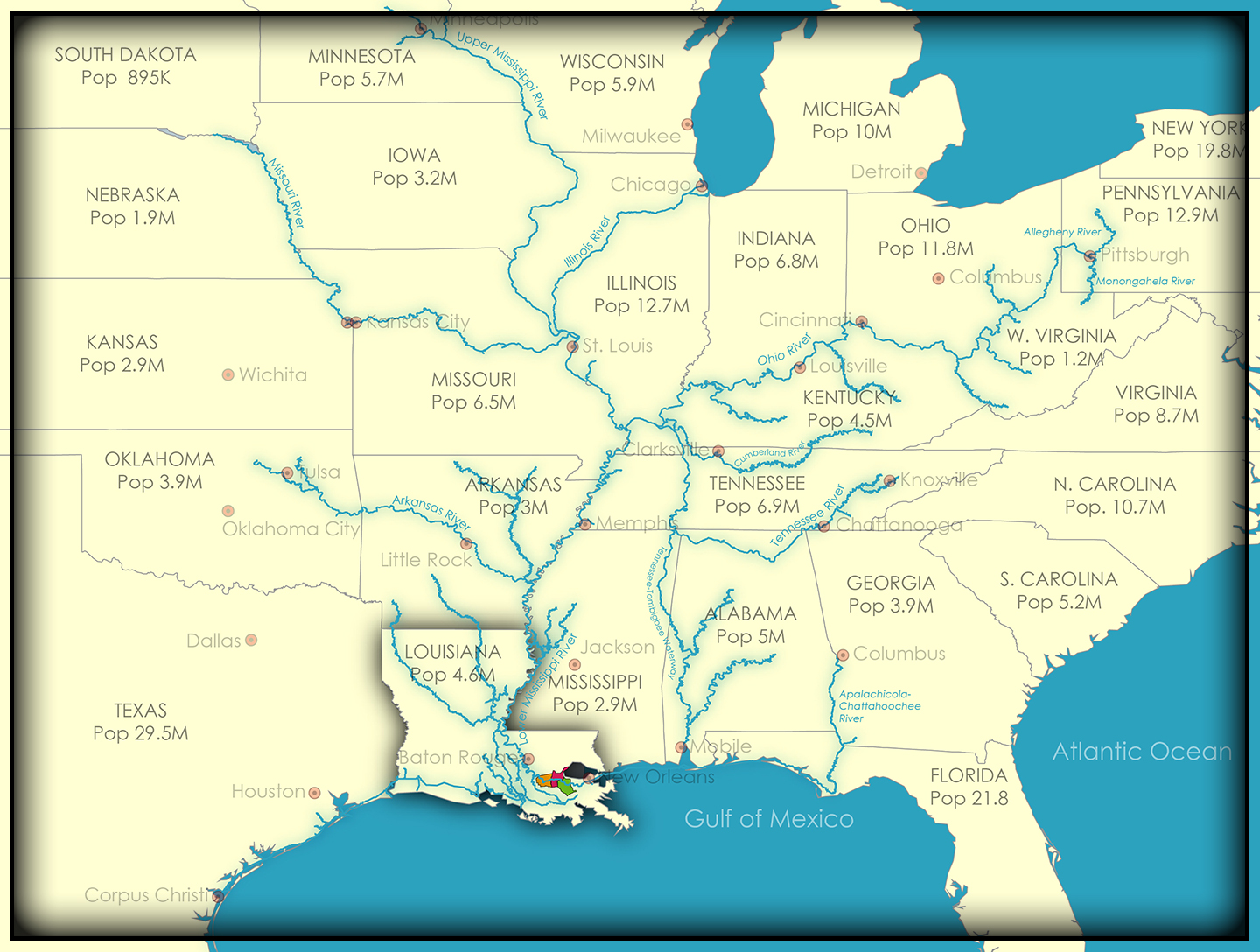
The U.S. inland river system
is comprised of 19,262 miles
[ 30,992 kilometers ] of waterways.
Port of South Louisiana’s
industrial parners
line 108 miles [ 174 kilometers ]
along both the east and west banks of the Mississippi River
The draft within
Port of South Louisiana’s district
is generally 48 feet [ 14.6 meters ]
248.1M tons of cargo
passing through the inland river system
is handled by the Port of South Louisiana
STATE and INTERSTATE HIGHWAYS
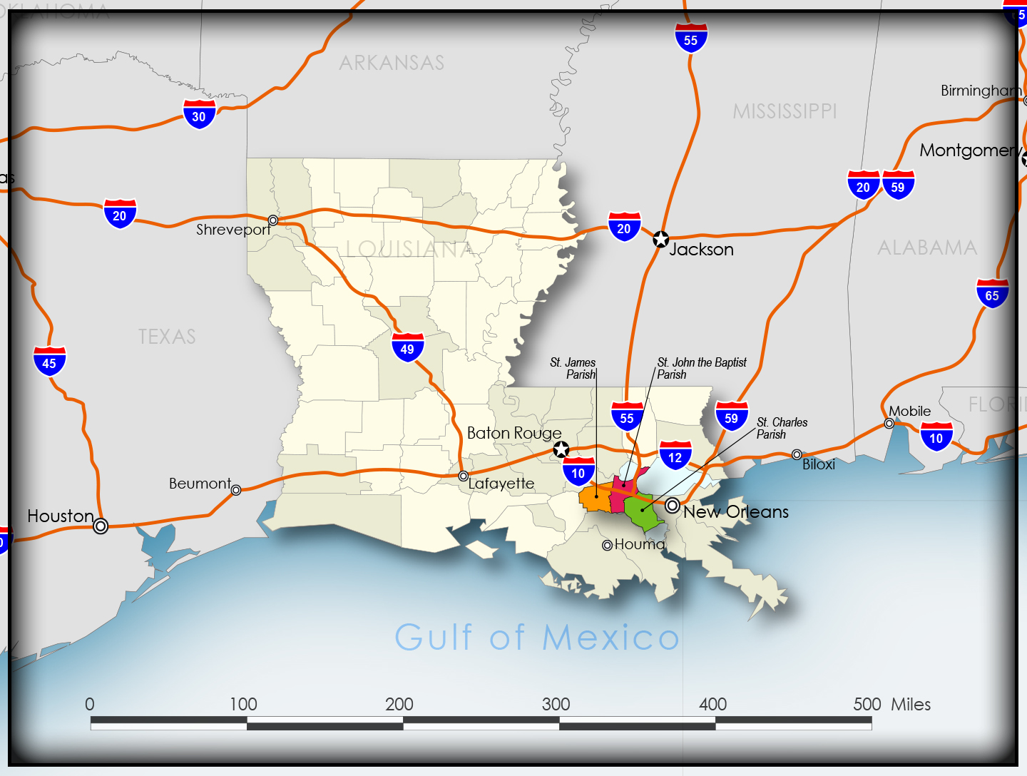
I-10, I-55
[ direct access ]
I-12, I-59
[ indirect access ]
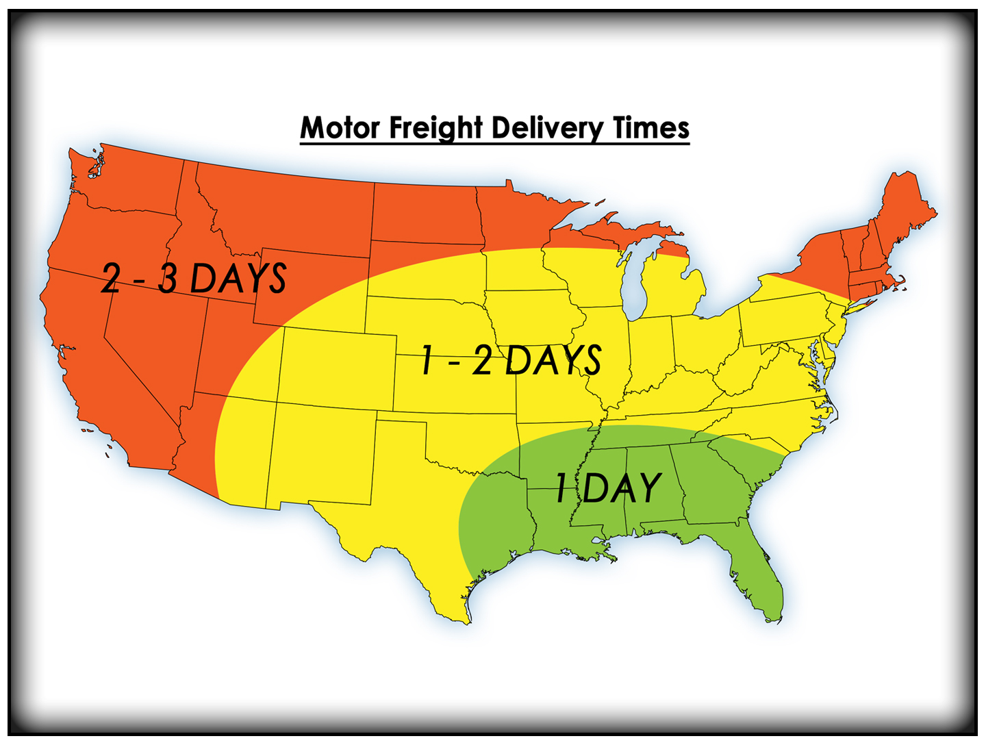
Twenty [ 20 ] metro areas are located within 600 miles
Commuting Times:
New Orleans, LA – 20 miles
Hammond, LA – 30 miles
Jackson, MS – 160 miles
Mobile, AL – 165 miles
Houston, TX – 320 miles
Little Rock, AR – 415 miles
Dallas, TX – 465 miles
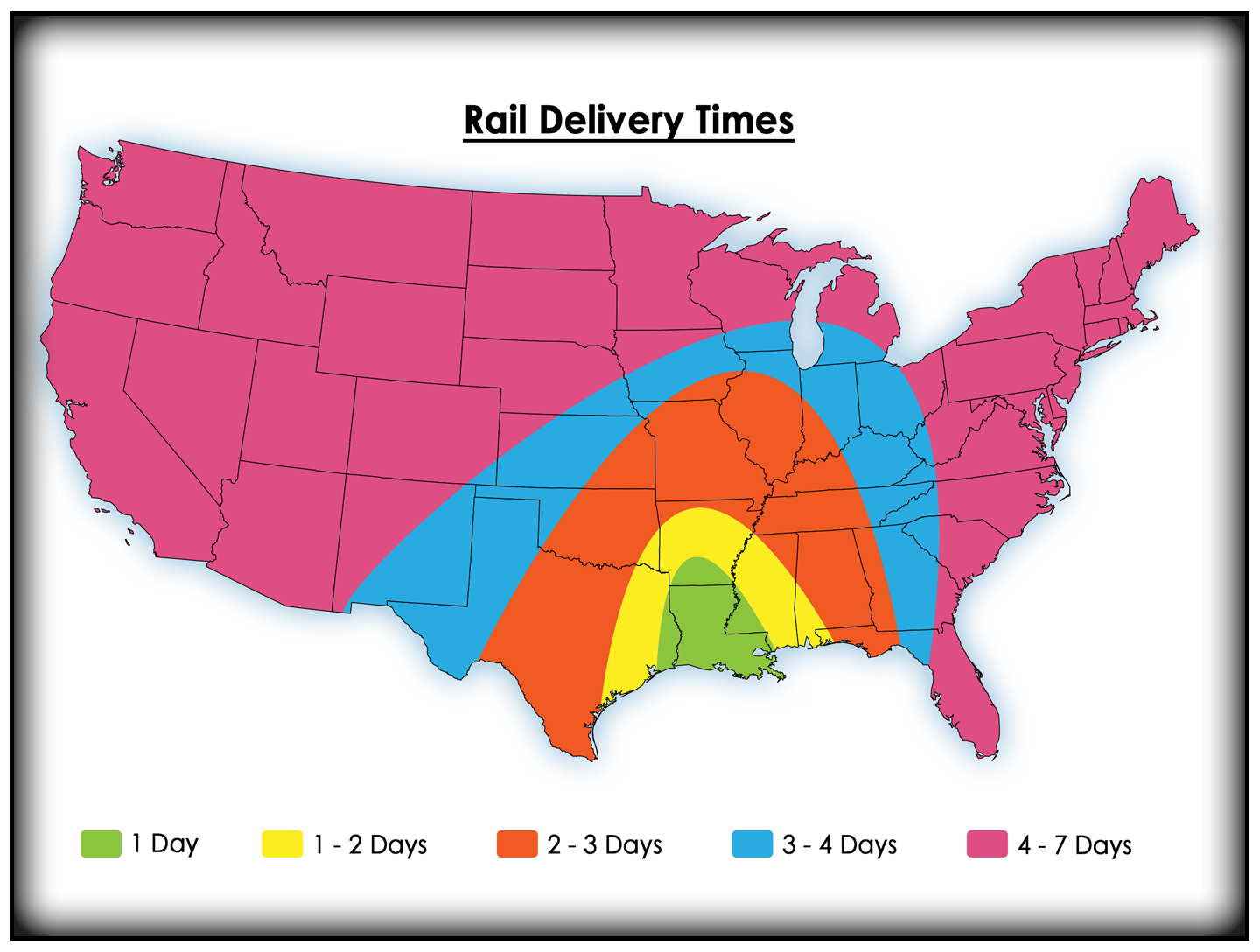
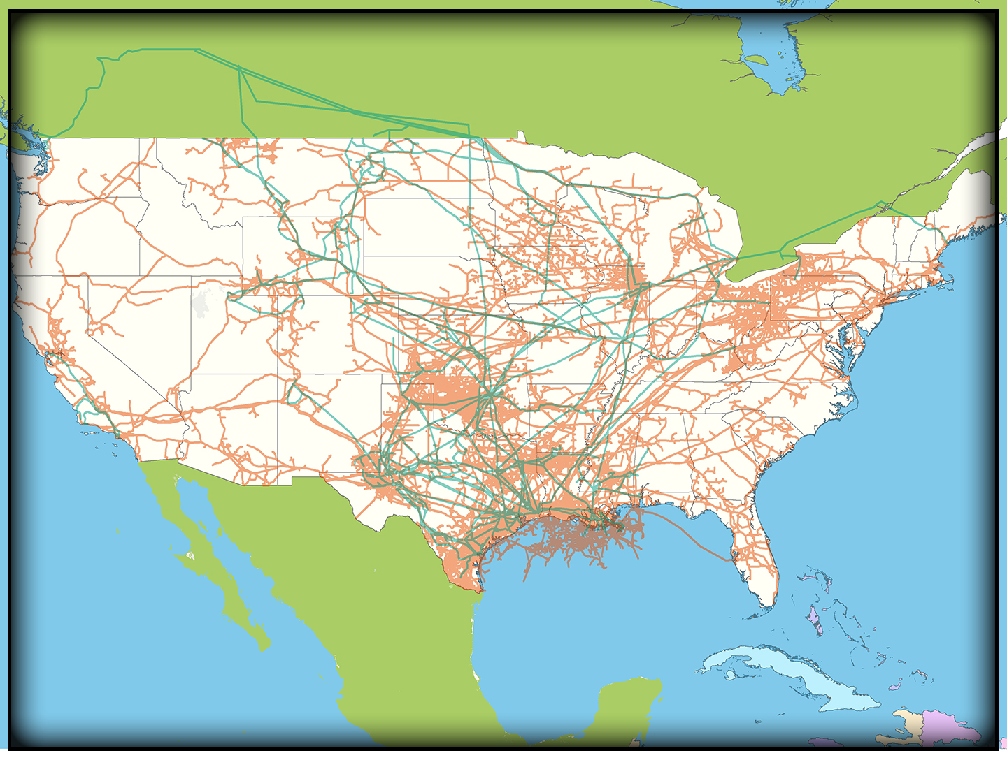
RAIL
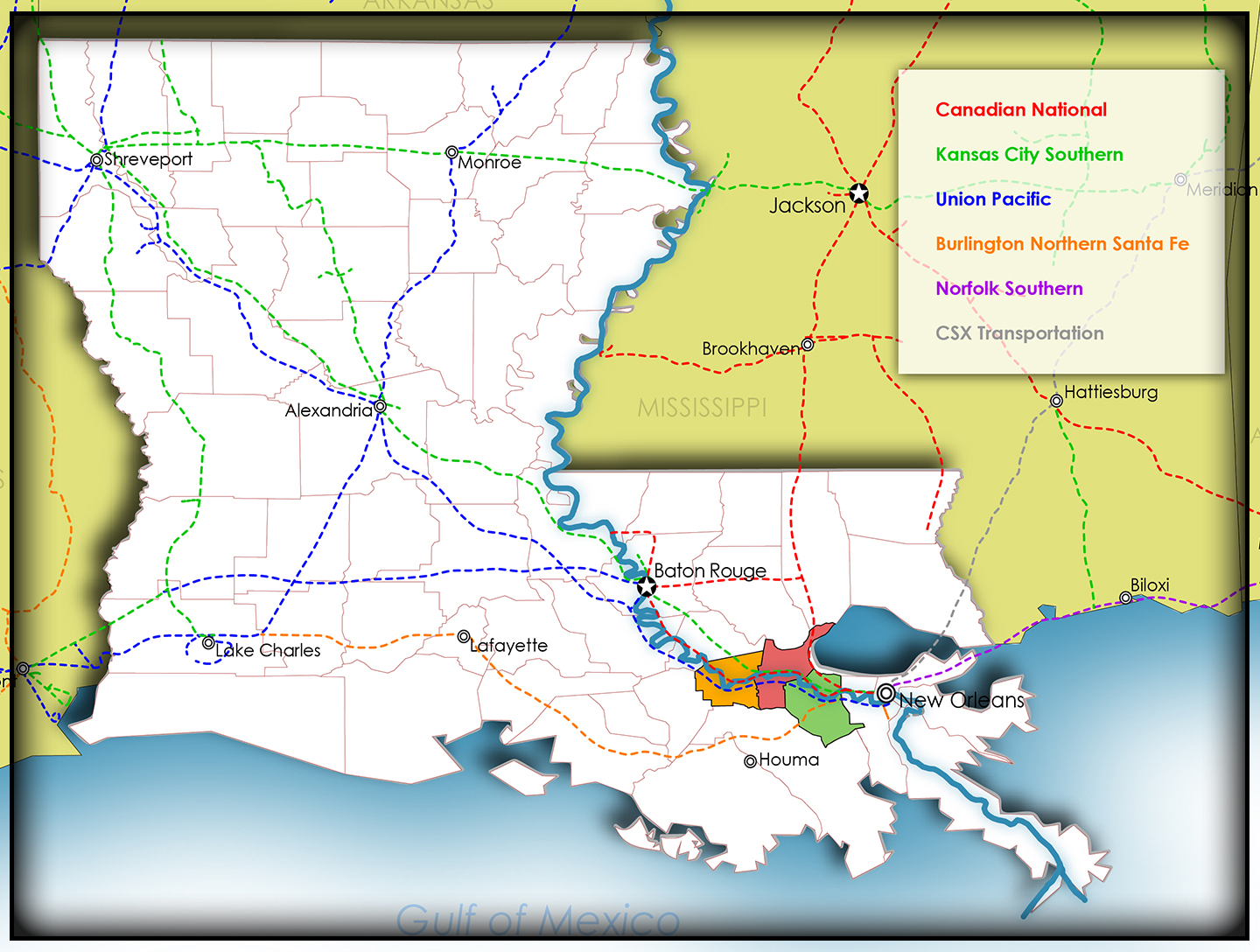
Served by three [ 3 ]
trunk line railroads
East Bank
Canadian National RR
Canadian Pacific Kansas City RR
West Bank
Union Pacific RR
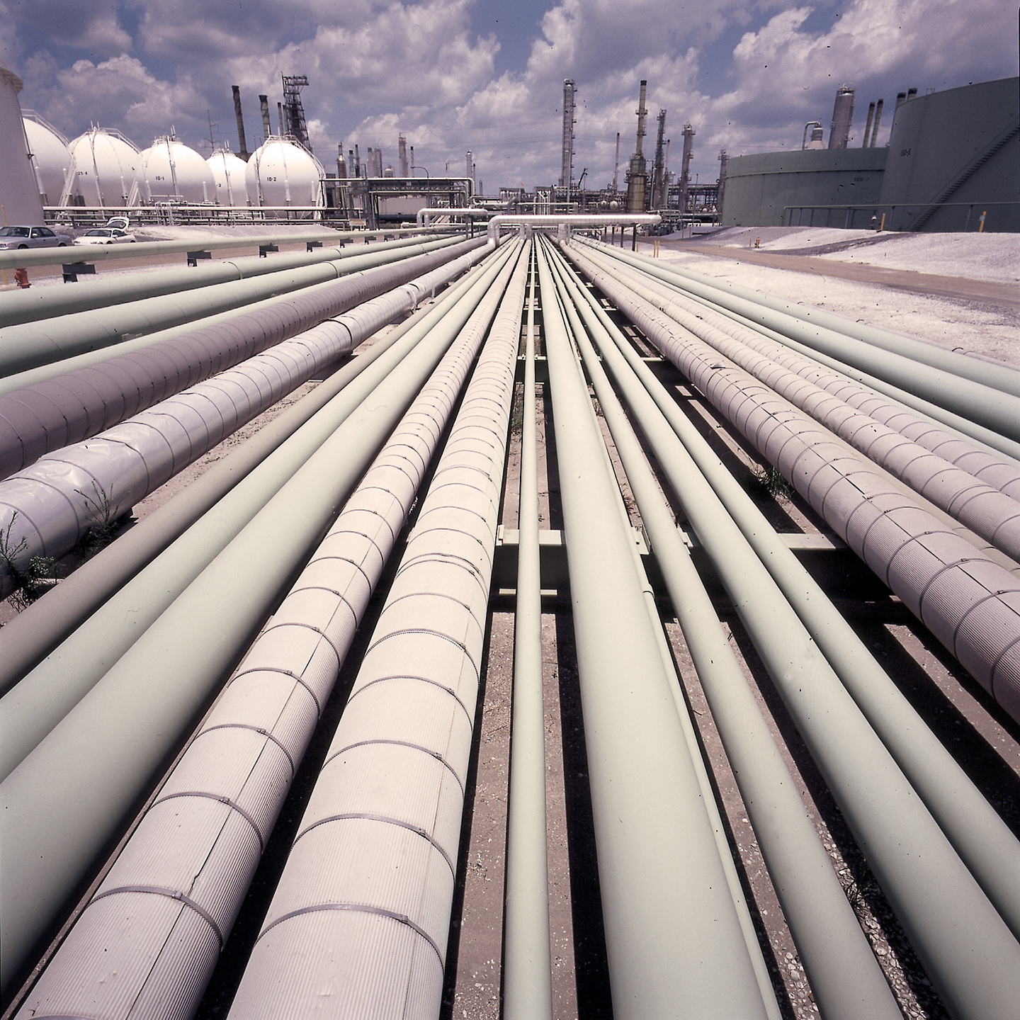
PIPELINES
Six [6] major oil and gas pipelines
192 total pipelines
Terminus for
Louisiana Offshore Oil Port [LOOP],
providing 1.1M barrels of crude/day
Originating point for Capline,
a 640-mile [1,030 kilometer] pipeline
that carries an average of
1.3M barrels/day to the Midwest
AIR
NEW ORLEANS
INTERNATIONAL AIRPORT
(aka Louis Armstrong)
is 10 minutes away from
Port of South Louisiana’s easternmost border
Daily passenger services
Commercial air services
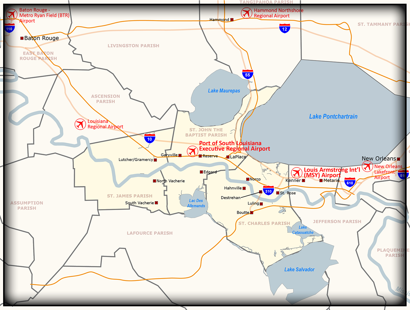
Port of South Louisiana’s
EXECUTIVE REGIONAL AIRPORT
is located in the center of the port’s disctrict
Private passenger services
Corporate air services
Air freight services and storage
(cold included)